Mountain guide
Aspromonte National Park guide
Aspromonte National Park covers about 64,000 hectares of the mountain massif at the toe of Italy, rising between the Tyrrhenian and Ionian seas to Montalto at about 1,955 meters, with the Strait of Messina below. Created in 1989 and a UNESCO Global Geopark since 2021, it mixes beech and fir forest, dry stony riverbeds and villages where a Greek dialect survives. Gambarie, the main mountain base, is about 1 hour 45 minutes to 2 hours by car from Tropea; Pentedattilo and the Greek-speaking villages each need a full day.
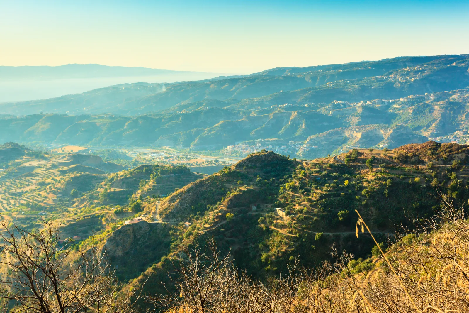
Aspromonte is the last mountain of the Italian peninsula
The Aspromonte rises straight out of two seas above Reggio Calabria and looks across the Strait of Messina to Sicily. Its slopes run through every Calabrian landscape in a few kilometers: citrus groves, vines and olives along the coast (bergamot grows commercially only in the southern Aspromonte), oak and holm oak below 1,000 meters, then pine, Sicilian fir and beech higher up.
The other signature is the fiumara, a wide bed of pale stones that carries little or no water for much of the year and turns to torrent in winter, when streams at altitude form waterfalls such as those at Maesano and Salino. The park was established in 1989 as one of Italy's earliest national parks, and since April 2021 it has been part of UNESCO's network of Global Geoparks.
| Fact | Detail |
|---|---|
| Created | 1989, the sixth national park established in Italy |
| Area | About 64,000 ha (641.5 km²) |
| Highest peak | Montalto, about 1,955 m |
| UNESCO status | Global Geopark since April 2021 |
| Main mountain base | Gambarie, about 1,350 m, in Santo Stefano in Aspromonte |
| Wildlife to know | Wolf, wildcat, otter, Bonelli's eagle, golden eagle; the rare fern Woodwardia radicans |
Montalto and Gambarie are the high country above the strait
Montalto, at about 1,955 meters, is the summit of the massif, crowned by a bronze statue of Christ the Redeemer first inaugurated on 23 September 1901 for the Jubilee. The original was modeled by Francesco Jerace; the statue there now is by the Reggio sculptor Michele di Raco. The summit lies in the comune of Samo, and the view takes in eastern Sicily and Calabria as far north as the Sila.
Most visitors start from Gambarie, a resort at about 1,350 meters in the comune of Santo Stefano in Aspromonte, with five ski runs in winter. Its chairlift, open for much of the year, rises to the top of Monte Scirocco, where the view runs from Etna to the Aeolian Islands. Gambarie is only about 40 to 50 minutes by road from central Reggio, so it pairs well with a museum morning in the city.
History is close by too. About 7 km from Gambarie stands the Cippo di Garibaldi, the memorial linked to the Battle of Aspromonte, where Garibaldi was defeated and captured on 29 August 1862 during his march on Rome. Long-distance walkers know the Sentiero del Brigante, which runs from Gambarie north to Serra San Bruno or Stilo.
Pentedattilo is a village built into a stone hand
Pentedattilo clings to a rock whose pinnacles once resembled five fingers, which is what its Greek name means. It is a frazione of Melito di Porto Salvo near the Ionian coast, with the old village at about 320 meters. Tradition makes it a colony of Chalcis founded in 640 BC, and it kept its Greek language until the late 19th century.
Its story is darker than its silhouette. On the night of 16 April 1686, Baron Bernardino Abenavoli stormed the castle in the killings remembered as the Strage degli Alberti. The 1783 earthquake drove many residents down to the coast; the village was declared uninhabitable in 1968 and abandoned for good in 1971. From the 1980s volunteers from across Europe restored parts of it, and an international short film festival, the Pentedattilo Film Festival, is held there between August and September.
Wear proper shoes: the lanes are steep and uneven, and much of the village is still empty, so carry water with you.
The Grecanico villages still keep a Greek dialect alive
In the valleys on the Ionian side, a handful of villages still speak the Greek of Calabria, a living link to the area's Greek and Byzantine past. The language is at serious risk of disappearing and survives mostly at home, so treat a visit as a chance to listen rather than to expect a show.
Bova, at about 820 meters, is the best known: a member of I Borghi più belli d'Italia and the heart of the Bovesia, one of the two Greek-speaking areas left in southern Italy. Gallicianò, a frazione of Condofuri at 621 meters on the Amendolea river, has about 60 inhabitants and is called the Acropolis of Magna Graecia because it is the only village that is still entirely Greek-speaking. It has a small Orthodox church, Panaghìa tis Elladas, completed in 1999, and a little ethnographic museum. Below them, Roghudi Vecchio was abandoned after floods in 1971 and 1973, and a new Roghudi was built near the coast in 1988.
The full village-by-village guide is in Greek-speaking villages of Aspromonte, and the wider list of Calabrian borghi is in most beautiful villages in Calabria.
How to plan an Aspromonte day from Tropea
Choose one side of the mountain per day: the high country around Gambarie, or the Ionian foothills with Pentedattilo and the Greek-speaking villages. Distances look short on a map, but the roads are narrow and winding, and the last stretch to Gallicianò runs along a cliff edge. A confident driver, or a hired one, makes the day far easier; see private drivers in Calabria.
- September and October are good walking months at altitude; take a layer for Gambarie and Montalto.
- For a slower route through both mountain parks, see the Sila National Park guide and plan them on separate days.
| Plan | Drive from Tropea | What it covers |
|---|---|---|
| Gambarie and the high country | About 1 h 45 min to 2 h | Chairlift views to Etna, forest walks, the Garibaldi memorial |
| Reggio plus Gambarie | About 1 h 30 min to Reggio, then 40 to 50 min up | Museum morning, mountain afternoon |
| Pentedattilo | About 2 h to 2 h 15 min | The rock village and the Ionian coast |
| Bova and Gallicianò | About 2 h 30 min to 2 h 45 min | Greek-speaking villages on mountain roads |
Planning Calabria?
Hear when 2027 dates open
A small group of women, one week in Tropea, everything arranged. Join the list for first word on dates and an occasional letter from Calabria.
One email when 2027 dates open, and an occasional letter from Calabria. Unsubscribe any time.
Questions
Do people still speak Greek in the Aspromonte?
Yes, a minority still speak the Greek of Calabria, mainly in the Bovesia area around Bova. Gallicianò is the only village where it remains the language of everyone, and even there it survives mostly at home and is considered seriously endangered.
Can you see Etna from the Aspromonte?
On a clear day, yes. From the top of Monte Scirocco, reached by the chairlift from Gambarie, the view runs from Etna to the Aeolian Islands, and Montalto looks over eastern Sicily.
Why was Pentedattilo abandoned?
The 1783 earthquake began its decline by pushing residents toward the coast. The old village was declared uninhabitable in 1968 and emptied in 1971, then partly restored by volunteers from the 1980s onward.
Is there skiing in the Aspromonte?
Yes, at Gambarie, which has five runs with lifts and a maximum drop of about 400 meters. The chairlift to Monte Scirocco is open for much of the year, so walkers can use it outside the snow season too.
Sources and further reading
- Wikipedia: Aspromonte National Park
- Wikipedia (Italian): Parco nazionale dell'Aspromonte
- Wikipedia (Italian): Montalto (Aspromonte)
- Wikipedia (Italian): Pentedattilo
- Wikipedia (Italian): Gallicianò
Checked November 19, 2026. Timetables, prices and opening hours change; confirm before you travel.
Keep reading
Related guides